The French motorway network exceeds twelve thousand kilometers, divided between sections granted to private companies and non-granted sections managed by the State. Finding a reliable and updated map requires distinguishing institutional sources from commercial datasets, whose updates depend on editorial cycles that can be several months out of sync.
National Road Reference on data.gouv.fr: the primary technical source
The Ministry of Ecology publishes on data.gouv.fr a static reference of the non-granted national road network. This dataset covers the motorways directly managed by the State, with a level of detail sufficient to reconstruct a vector map at any scale.
The value of this source lies in its granularity. The geometries are provided in GeoJSON or Shapefile format, usable in QGIS or any desktop GIS. We recommend this entry point to anyone needing to overlay the motorway layout with other layers (traffic, road events, concession perimeters).
The granted network (Vinci Autoroutes, Sanef, APRR, AREA, ATMB, SFTRF) does not always appear in this reference. To obtain a consolidated view including tolls and rates, one must cross-reference data from data.gouv.fr with that from the autoroutes.fr portal, which publishes the tariff grids and travel times between major interchanges each year.
Having an updated map of the motorways in France for 2026 therefore involves combining at least two complementary data streams, one for the network geometry and the other for operational information.

IGN Cartographic Data under Open Etalab License: Free Printing and Reuse
The IGN now disseminates its cartographic data via cartes.gouv.fr under an open Etalab license. This license allows reproduction, printing, and redistribution without prior authorization, including for associative or professional use.
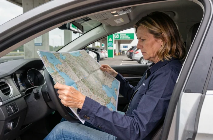
For a driver preparing a trip from Paris to Lyon or a route north without relying on a mobile connection, these datasets are the best printing option. The resolution allows for a readable output up to A3 format, featuring motorway axes, major interchanges, and service areas.
Download and Available Formats
Cartes.gouv.fr offers several zoom levels. The most useful for a national view of the motorways corresponds to the scale of 1:1,000,000. At this scale, each motorway segment appears with its designation (A1, A6, A75, etc.) and the landmark cities (Paris, Lyon, Saint-Étienne, Bordeaux).
- Raster format (JPEG, PNG): suitable for direct printing, without specialized software. Downloadable in just a few clicks from the cartes.gouv.fr interface.
- Vector format (WMS, WMTS): usable in a GIS to overlay custom layers (toll areas, free motorways, construction segments).
- Enhanced OpenStreetMap tiles: some third-party applications integrate IGN data via the Geoplatform API, with near-continuous updates of the network.
OpenStreetMap and Vector Maps: Creating Your Own Motorway Map
OpenStreetMap remains the most comprehensive contributory base for the French road network. The motorways are classified according to the highway=motorway nomenclature, with detailed attributes (number of lanes, maximum speed, concession manager).
The quality of motorway coverage in France is excellent. Each segment, including ramps and interchanges, is mapped by local contributors who correct changes within days after the opening of a new axis or the closure of an interchange.
Extraction and Rendering Tools
To generate a printable map from OpenStreetMap, the Overpass Turbo tool allows for the extraction of only those objects tagged highway=motorway within metropolitan France. The result, exportable in GeoJSON, can then be loaded into uMap or QGIS for a customized cartographic rendering.
This approach is suitable for transport or logistics professionals who need a thematic map (free vs. granted motorways, north-south vs. east-west axes) without relying on a commercial publisher.
Free and Granted Motorways: What the Map Must Distinguish
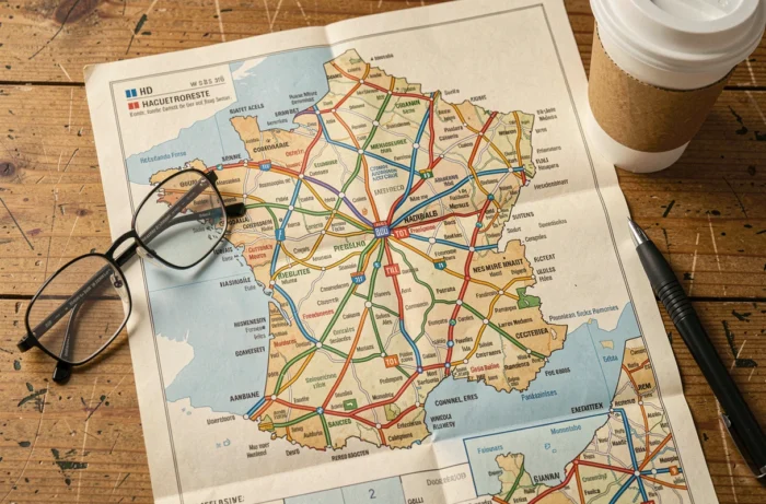
About a quarter of the French motorway network is non-granted, meaning nearly three thousand kilometers are accessible without tolls. The A75, which connects Clermont-Ferrand to Béziers, is the longest and best-known segment. Urban and bypass motorways (A86, sections of A6 in Île-de-France) complete this free network.
A useful map visually distinguishes toll sections from free sections. Neither the standard IGN background nor the default OpenStreetMap map makes this distinction. One must resort to a custom rendering or thematic maps published by the concession companies themselves.
- Autoroutes.fr publishes an interactive map with toll rates by segment and vehicle classification, updated annually.
- The concession companies (APRR, Sanef, Vinci) distribute their own network maps, limited to their geographical scope.
- Fulli offers an interactive map covering the entire granted network, with associated toll information.
Reliability of Updates: Criteria for Evaluating a Motorway Map
The date of the last update is not enough to guarantee the reliability of a map. We regularly observe discrepancies between the displayed date and the actual integration of network changes (opening of new segments, renumbering, permanent closures).
Three criteria allow for the real reliability of a cartographic source to be evaluated. The first is traceability: does the source indicate where its data comes from (IGN, data.gouv.fr, OpenStreetMap)? The second is the frequency of updates, which should be at least annual for a motorway network. The third is coverage: some maps omit non-granted motorways or free urban sections.
Datasets from data.gouv.fr and IGN via cartes.gouv.fr check all three boxes. Commercial maps integrated into GPS or navigation applications (Waze, Google Maps) benefit from frequent updates but do not allow for printing or free reuse of the data.
The choice between these sources depends on the use: quick screen consultation, printing for a trip without connection, or integration into a professional geographic information system. In all cases, cross-referencing at least two sources remains the safest method to have a complete and updated motorway layout.